Geolocate

Varadero topographic map

Click on the map to display elevation.

About this map

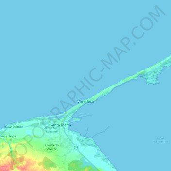
Name: Varadero topographic map, elevation, terrain.

Location: Varadero, Matanzas, Cuba (23.12819 -81.32090 23.20537 -81.11188)

Average elevation: 3 m

Minimum elevation: -3 m

Maximum elevation: 61 m

Gear up for your next adventure:

🧦Crew Hiking Socks - Comfortable socks for long-distance hikes
👖Convertible Hiking Pants - Zip-off legs to adapt to changing weather conditions
🥾Hiking Shoes - Durable and comfortable shoes for trail hiking
🧼Travel Hand Sanitizer - Keep hands clean when water is scarce
🧦Thermal Socks - Warm socks for winter hiking or camping

As an Amazon Associate, this site earns from qualifying purchases at no extra cost to you.