Geolocate

Pommeyrol topographic map

Click on the map to display elevation.

About this map
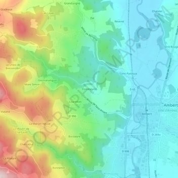
Name: Pommeyrol topographic map, elevation, terrain.

Location: Pommeyrol, Ambert, Puy-de-Dôme, Auvergne-Rhône-Alpes, France métropolitaine, 63600, France (45.53403 3.69644 45.57403 3.73644)

Average elevation: 633 m

Minimum elevation: 514 m

Maximum elevation: 904 m

Other topographic maps

Click on a map to view its topography, its elevation and its terrain.

Valeyre

France > Auvergne-Rhône-Alpes > Puy-de-Dôme > Ambert

Average elevation: 668 m

63600

France > Auvergne-Rhône-Alpes > Puy-de-Dôme > Ambert > Goyes

Average elevation: 897 m

Gear up for your next adventure:

🧦Outdoor Socks - Durable socks designed for hiking and outdoor sports
👟Trail Running Shoes - Agile footwear for fast-paced topographic exploration
🥾Lightweight Hiking Boots - Boots for comfort and mobility on long hikes
👖Convertible Hiking Pants - Zip-off legs to adapt to changing weather conditions
🧰Multitool Knife - Compact and versatile tool for outdoor use

As an Amazon Associate, this site earns from qualifying purchases at no extra cost to you.