Geolocate

Templeton topographic map

Click on the map to display elevation.

About this map

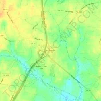
Name: Templeton topographic map, elevation, terrain.

Location: Templeton, Prince George County, Virginia, United States (37.06237 -77.37498 37.10237 -77.33498)

Average elevation: 40 m

Minimum elevation: 22 m

Maximum elevation: 54 m

Gear up for your next adventure:

🚲MTB Frame Bag - Carry tools and maps directly on your bicycle frame
🧊Portable Cooler - Keep food and drinks cold during outdoor adventures
🧦Merino Wool Socks - Moisture-wicking comfort for long-distance hiking
🥾Trail Hiking Shoes - Durable shoes designed for rugged trails
🔦UV Flashlight - Detect minerals or specific insects in the dark

As an Amazon Associate, this site earns from qualifying purchases at no extra cost to you.