
Thank you for supporting this site ❤️
Make a donation
Make a donation
Gear up for your next adventure:
As an Amazon Associate, this site earns from qualifying purchases at no extra cost to you.
Pichincha topographic map
Click on the map to display elevation.
Thank you for supporting this site ❤️
Make a donation
Make a donation
Gear up for your next adventure:
As an Amazon Associate, this site earns from qualifying purchases at no extra cost to you.
About this map
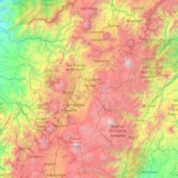
Name: Pichincha topographic map, elevation, terrain.
Location: Pichincha, Ecuador (-0.72106 -79.37090 0.32727 -77.83973)
Average elevation: 2,503 m
Minimum elevation: 231 m
Maximum elevation: 5,818 m
Thank you for supporting this site ❤️
Make a donation
Make a donation
Gear up for your next adventure:
As an Amazon Associate, this site earns from qualifying purchases at no extra cost to you.
Other topographic maps
Click on a map to view its topography, its elevation and its terrain.
San Fransisco
Ecuador > Cotopaxi > Latacunga > Latacunga > Tilipulo > San Fransisco
Average elevation: 2,887 m