Geolocate

Bertram topographic map

Click on the map to display elevation.

About this map

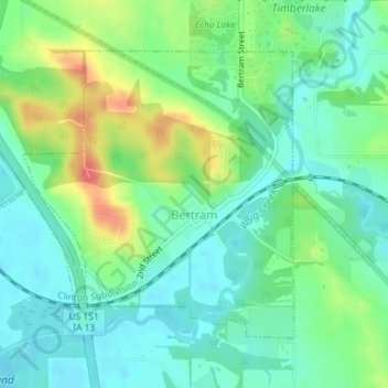
Name: Bertram topographic map, elevation, terrain.

Location: Bertram, Linn County, Iowa, United States (41.94152 -91.55637 41.96151 -91.52584)

Average elevation: 232 m

Minimum elevation: 213 m

Maximum elevation: 270 m

Other topographic maps

Click on a map to view its topography, its elevation and its terrain.

New Buffalo

United States > Iowa > Linn County > Cedar Rapids

Average elevation: 253 m

Lindale Manor

United States > Iowa > Linn County > Marion

Average elevation: 252 m

Covington

United States > Iowa > Linn County

Average elevation: 239 m

Paris

United States > Iowa > Linn County

Average elevation: 269 m

Gear up for your next adventure:

🧴Waterproofing Spray - Restore the DWR coating on jackets and tents
🥾Hiking Gaiters - Protect legs and shoes from mud, snow, and debris
🧥Ultralight Puffy Jacket - Maximum warmth that packs down to the size of an orange
🧢Hiking Hat - Sun-protective and breathable hats for long treks
🔦LED Flashlight - Powerful and long-lasting flashlight for camping and emergencies

As an Amazon Associate, this site earns from qualifying purchases at no extra cost to you.