
Golija topographic map
Interactive map
Click on the map to display elevation.
Golija
There are four lakes on the mountain. At the altitude of 900 metres (3,000 ft) there are the Košanin Lakes, on the Crepuljnik's northern slopes. A natural phenomenon, where the water rescinds during the rain, and the water level rise in dry periods. There are two lakes, Great and Little Košanin Lake. They were named after biologist Nedeljko Košanin, who explored Golija in general. The Great Lake has only a small open surface area, as it is fully engulfed in bog vegetation. Small Lake is 90 metres (300 ft) long and partially salty. Third, Dajićko Lake, in time shrunk by half, though it has been protected since the late 1960s. It is also covered in algae and bog vegetation. Located on the northwestern slope of Golija, it is also locally known as Tičar Lake. Formerly encircled by the tall spruce forest which allowed sunlight only during the zenith, the forests thinned in time, which caused vegetation change both around and in the lake itself. Livestock grazing around the lake is forbidden. Numerous folk myths exist about the lake, which used to be a location of various folk rites. Myths include stories of the lake as a gathering spot of the most beautiful fairies and a popular story of the wedding party which drowned in the lake. The fourth lake, Nebeska Suza ("heaven's teardrop"), appeared after the 1977 Vrancea earthquake, and is the least explored. Though the youngest, it is the largest natural lake in the Moravica region.
About this map
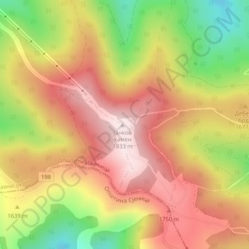
Name: Golija topographic map, elevation, terrain.
Average elevation: 1,631 m
Minimum elevation: 1,368 m
Maximum elevation: 1,828 m