Geolocate

Truro topographic map

Click on the map to display elevation.

About this map

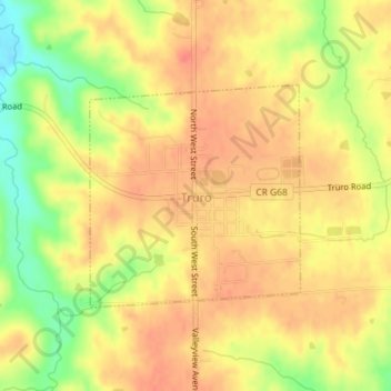
Name: Truro topographic map, elevation, terrain.

Location: Truro, Madison County, Iowa, United States (41.20211 -93.85639 41.21750 -93.83705)

Average elevation: 322 m

Minimum elevation: 285 m

Maximum elevation: 342 m

Other topographic maps

Click on a map to view its topography, its elevation and its terrain.

Barney

United States > Iowa > Madison County

Average elevation: 346 m

Gear up for your next adventure:

Camping Groundsheet - Protect your tent from moisture and dirt
🥾Hiking Shorts - Breathable shorts suitable for summer hikes
🥾Hiking Boots - Sturdy boots providing ankle support and traction on rugged trails
👖Convertible Hiking Pants - Zip-off legs to adapt to changing weather conditions
🎒Hiking Daypack - Lightweight and durable backpacks for day trips and excursions

As an Amazon Associate, this site earns from qualifying purchases at no extra cost to you.