
Thank you for supporting this site ❤️
Make a donation
Make a donation
Gear up for your next adventure:
As an Amazon Associate, this site earns from qualifying purchases at no extra cost to you.
Palmira topographic map
Click on the map to display elevation.
Thank you for supporting this site ❤️
Make a donation
Make a donation
Gear up for your next adventure:
As an Amazon Associate, this site earns from qualifying purchases at no extra cost to you.
About this map
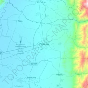
Name: Palmira topographic map, elevation, terrain.
Location: Palmira, Sur, Valle del Cauca, 76520, Colombia (3.37084 -76.45880 3.69084 -76.13880)
Average elevation: 1,179 m
Minimum elevation: 939 m
Maximum elevation: 3,601 m
Thank you for supporting this site ❤️
Make a donation
Make a donation
Gear up for your next adventure:
As an Amazon Associate, this site earns from qualifying purchases at no extra cost to you.