Geolocate

Lolmie topographic map

Click on the map to display elevation.

About this map
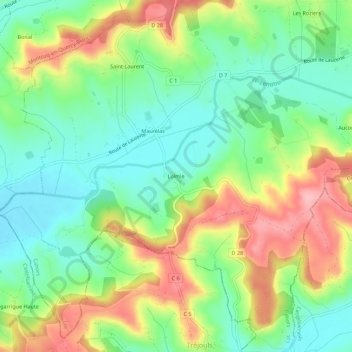
Name: Lolmie topographic map, elevation, terrain.

Location: Lolmie, Saint-Laurent-Lolmie, Lendou-en-Quercy, Cahors, Lot, Occitanie, France métropolitaine, 46800, France (44.26667 1.21174 44.30667 1.25174)

Average elevation: 180 m

Minimum elevation: 124 m

Maximum elevation: 266 m

Other topographic maps

Click on a map to view its topography, its elevation and its terrain.

Lascabanes

France > Occitanie > Lot > Lendou-en-Quercy

Average elevation: 229 m

Saint-Cyprien

France > Occitanie > Lot > Lendou-en-Quercy

Average elevation: 204 m

Gear up for your next adventure:

💡LED Camping Lantern - Illuminate your campsite with long-lasting lanterns
🧊Portable Cooler - Keep food and drinks cold during outdoor adventures
🧥Thermal Layer - Insulating layer for cold outdoor conditions
⛺Camping Tent - Weather-resistant tents suitable for 2 to 6 people
🌡️Emergency Mylar Blankets - Compact thermal protection for unexpected nights outdoors

As an Amazon Associate, this site earns from qualifying purchases at no extra cost to you.