
Forest City topographic map
Click on the map to display elevation.
About this map
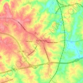
Name: Forest City topographic map, elevation, terrain.
Average elevation: 285 m
Minimum elevation: 235 m
Maximum elevation: 326 m
Other topographic maps
Click on a map to view its topography, its elevation and its terrain.
Chimney Rock
United States > North Carolina > Rutherford County > Chimney Rock
Average elevation: 550 m