
Comanche County topographic map
Interactive map
Click on the map to display elevation.
About this map
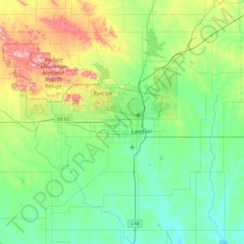
Name: Comanche County topographic map, elevation, terrain.
Location: Comanche County, Oklahoma, USA (34.40834 -98.82635 34.85549 -98.08893)
Average elevation: 388 m
Minimum elevation: 290 m
Maximum elevation: 737 m
Other topographic maps
Click on a map to view its topography, its elevation and its terrain.
Locust Grove
USA > Oklahoma > Locust Grove
Locust Grove, Mayes County, Oklahoma, 74352, USA
Average elevation: 213 m
Razorback Mountain
Razorback Mountain, Pushmataha County, Oklahoma, 74557, USA
Average elevation: 231 m