Geolocate

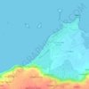
Tri Mean topographic map

Click on the map to display elevation.

About this map

Name: Tri Mean topographic map, elevation, terrain.

Location: Tri Mean, Guissény, Brest, Finistère, Bretagne, France métropolitaine, 29880, France (48.61076 -4.46411 48.65076 -4.42411)

Average elevation: 20 m

Minimum elevation: -1 m

Maximum elevation: 78 m

Other topographic maps

Click on a map to view its topography, its elevation and its terrain.
Gear up for your next adventure:

🥾Trekking Poles - Adjustable trekking poles to reduce knee stress and improve stability
👟Trail Running Shoes - Agile footwear for fast-paced topographic exploration
🚑Survival Whistle - Signal for help across long distances in mountains
👖Convertible Hiking Pants - Zip-off legs to adapt to changing weather conditions
🧭Orienteering Kit - Tools for map reading and navigation in the wild

As an Amazon Associate, this site earns from qualifying purchases at no extra cost to you.