Geolocate

Spineto topographic map

Click on the map to display elevation.

About this map

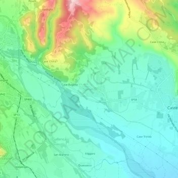
Name: Spineto topographic map, elevation, terrain.

Location: Spineto, Castellamonte, Torino, Piemonte, 10081, Italia (45.36613 7.66275 45.40613 7.70275)

Average elevation: 387 m

Minimum elevation: 324 m

Maximum elevation: 546 m

Gear up for your next adventure:

🥾Lightweight Hiking Boots - Boots for comfort and mobility on long hikes
🛰️Satellite Messenger - Emergency communication for areas with no cell service
🥾Mountain Hiking Boots - High-traction boots for rocky terrain
🧢Sun Hat - Wide-brim hat for sun protection
🥾Trail Hiking Boots - Supportive boots for rough trails

As an Amazon Associate, this site earns from qualifying purchases at no extra cost to you.