
Make a donation
Gear up for your next adventure:
As an Amazon Associate, this site earns from qualifying purchases at no extra cost to you.
Greenwood topographic map
Click on the map to display elevation.
Make a donation
Gear up for your next adventure:
As an Amazon Associate, this site earns from qualifying purchases at no extra cost to you.
About this map
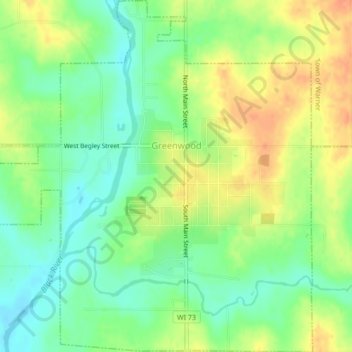
Name: Greenwood topographic map, elevation, terrain.
Location: Greenwood, Clark County, Wisconsin, United States (44.75233 -90.62339 44.78276 -90.58270)
Average elevation: 353 m
Minimum elevation: 334 m
Maximum elevation: 374 m
Make a donation
Gear up for your next adventure:
As an Amazon Associate, this site earns from qualifying purchases at no extra cost to you.
Other topographic maps
Click on a map to view its topography, its elevation and its terrain.
Lynn
United States > Wisconsin > Clark County
The history of Lynn, Wisconsin is deeply rooted in the early settlement and development of Clark County. Topics covered in the history of Clark County, Wisconsin, include topography, Indians, early government, early settlement, politics, lumbering, transportation, agriculture, education, the press, the courts,…
Average elevation: 355 m
Make a donation
Gear up for your next adventure:
As an Amazon Associate, this site earns from qualifying purchases at no extra cost to you.