Geolocate

Chamela topographic map

Click on the map to display elevation.

About this map

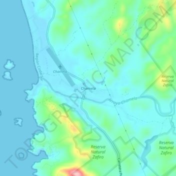
Name: Chamela topographic map, elevation, terrain.

Location: Chamela, La Huerta, Jalisco, 48854, Mexico (19.50960 -105.08936 19.54960 -105.04936)

Average elevation: 32 m

Minimum elevation: 0 m

Maximum elevation: 185 m

Gear up for your next adventure:

🎒Hiking Backpack - Lightweight and ergonomic backpacks for day hikes or multi-day treks
Camping Coffee Maker - Brew fresh coffee anywhere on the topographic map
🧦Crew Hiking Socks - Comfortable socks for long-distance hikes
🥾Waterproof Hiking Shoes - Durable shoes for wet and rugged trails
🦯Trekking Poles - Reduced impact on joints for steep topographic climbs

As an Amazon Associate, this site earns from qualifying purchases at no extra cost to you.