Geolocate

Igoji topographic map

Click on the map to display elevation.

About this map

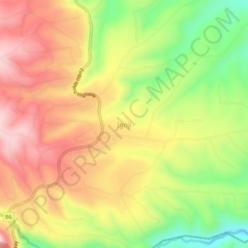
Name: Igoji topographic map, elevation, terrain.

Location: Igoji, Igoji East ward, Imenti South, Meru County, Kenya (-0.20800 37.66085 -0.16800 37.70085)

Average elevation: 1,309 m

Minimum elevation: 1,120 m

Maximum elevation: 1,470 m

Gear up for your next adventure:

🧳Compression Sacks - Maximize space in your backpack by shrinking gear
🥾Hiking Boots - Sturdy boots providing ankle support and traction on rugged trails
🥘Camping Cookware Set - Compact nesting pots and pans for trail cooking
🎒Hiking Daypack - Lightweight and durable backpacks for day trips and excursions
🦶Hiking Shoe Insoles - Added support for high arches and long days on feet

As an Amazon Associate, this site earns from qualifying purchases at no extra cost to you.