
Adah topographic map
Interactive map
Click on the map to display elevation.
About this map
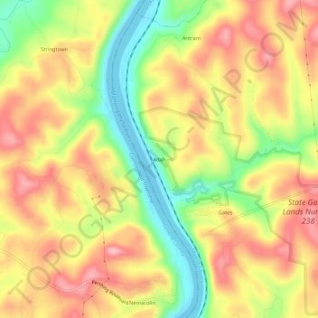
Name: Adah topographic map, elevation, terrain.
Average elevation: 319 m
Minimum elevation: 234 m
Maximum elevation: 388 m
Other topographic maps
Click on a map to view its topography, its elevation and its terrain.
McClellandtown
United States > Pennsylvania > Fayette County > German Township
McClellandtown, German Township, Fayette County, Pennsylvania, 15458, United States
Average elevation: 338 m
Leckrone
United States > Pennsylvania > Fayette County > German Township
Leckrone, German Township, Fayette County, Pennsylvania, 15454, United States
Average elevation: 327 m
Ronco
United States > Pennsylvania > Fayette County > German Township
Ronco, German Township, Fayette County, Pennsylvania, 15476, United States
Average elevation: 309 m