Geolocate

Chuyabamba topographic map

Click on the map to display elevation.

About this map

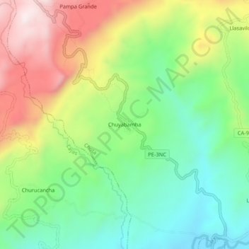
Name: Chuyabamba topographic map, elevation, terrain.

Location: Chuyabamba, Chota, Cajamarca, Perú (-6.53845 -78.72896 -6.49845 -78.68896)

Average elevation: 2,450 m

Minimum elevation: 2,205 m

Maximum elevation: 2,818 m

Gear up for your next adventure:

🍽️Titanium Camping Spork - Ultralight and indestructible eating utensil
🥾All-Terrain Hiking Boots - Versatile boots for varied hiking conditions
🥾Hiking Leggings - Comfortable leggings for outdoor activities
🚑Survival Whistle - Signal for help across long distances in mountains
🌬️Windproof Camp Stove - Efficient cooking even on exposed mountain peaks

As an Amazon Associate, this site earns from qualifying purchases at no extra cost to you.