Geolocate

Batiano topographic map

Click on the map to display elevation.

About this map

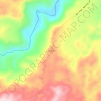
Name: Batiano topographic map, elevation, terrain.

Location: Batiano, Baganga, Davao Oriental, Davao Region, Philippines (7.49689 126.49531 7.53689 126.53531)

Average elevation: 229 m

Minimum elevation: 24 m

Maximum elevation: 419 m

Gear up for your next adventure:

🧴Sunscreen SPF - Broad-spectrum sunscreen for outdoor activities
🧦Outdoor Socks - Durable socks designed for hiking and outdoor sports
🥾Waterproof Trail Shoes - Shoes designed to handle wet terrain
🥾Durable Hiking Shoes - Long-lasting shoes for frequent hiking
🥾Waterproof Hiking Boots - Essential footwear for rugged terrain and wet Canadian trails

As an Amazon Associate, this site earns from qualifying purchases at no extra cost to you.