Geolocate

Tuck Lake topographic map

Click on the map to display elevation.

About this map

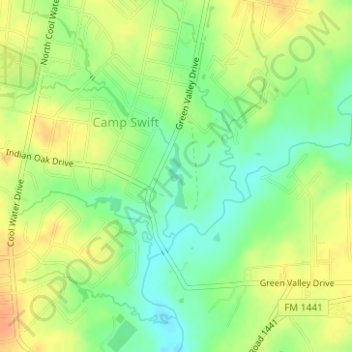
Name: Tuck Lake topographic map, elevation, terrain.

Location: Tuck Lake, Camp Swift, Bastrop County, Texas, United States (30.18059 -97.29363 30.18566 -97.29195)

Average elevation: 139 m

Minimum elevation: 120 m

Maximum elevation: 156 m

Gear up for your next adventure:

🏕️Camping Hammock - Integrated protection for sleeping between trees
🦶Hiking Shoe Insoles - Added support for high arches and long days on feet
🕶️Polarized Sunglasses - Protect your eyes with durable polarized lenses
🧴Outdoor Sunscreen - High SPF protection for high-altitude UV exposure
💡LED Camping Lantern - Illuminate your campsite with long-lasting lanterns

As an Amazon Associate, this site earns from qualifying purchases at no extra cost to you.