
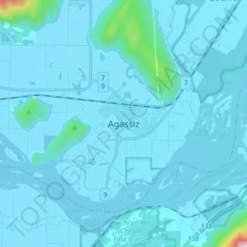
Agassiz topographic map
Click on the map to display elevation.
About this map
Name: Agassiz topographic map, elevation, terrain.
Average elevation: 48 m
Minimum elevation: 10 m
Maximum elevation: 1,001 m
Fraser Valley Regional District trails, hiking, mountain biking, running and outdoor activities
Other topographic maps
Click on a map to view its topography, its elevation and its terrain.
Harrison River
Canada > British Columbia > Fraser Valley Regional District > Kent > Harrison Mills
Average elevation: 45 m
Campbell Lake
Canada > British Columbia > Fraser Valley Regional District > Kent
Average elevation: 528 m
Hicks Lake
Canada > British Columbia > Fraser Valley Regional District > Kent
Average elevation: 377 m