
Thank you for supporting this site ❤️
Make a donation
Make a donation
Gear up for your next adventure:
As an Amazon Associate, this site earns from qualifying purchases at no extra cost to you.
Ambasaguas topographic map
Click on the map to display elevation.
Thank you for supporting this site ❤️
Make a donation
Make a donation
Gear up for your next adventure:
As an Amazon Associate, this site earns from qualifying purchases at no extra cost to you.
About this map
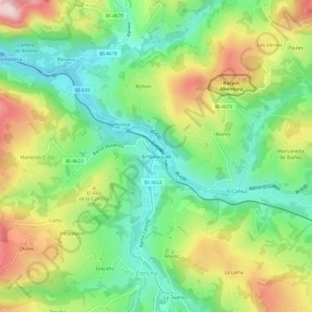
Name: Ambasaguas topographic map, elevation, terrain.
Location: Ambasaguas, Valle de Carranza, Vizcaya, País Vasco, España (43.21791 -3.37801 43.25791 -3.33801)
Average elevation: 246 m
Minimum elevation: 114 m
Maximum elevation: 450 m
Thank you for supporting this site ❤️
Make a donation
Make a donation
Gear up for your next adventure:
As an Amazon Associate, this site earns from qualifying purchases at no extra cost to you.