
Thank you for supporting this site ❤️
Make a donation
Make a donation
Gear up for your next adventure:
As an Amazon Associate, this site earns from qualifying purchases at no extra cost to you.
Tenorio topographic map
Click on the map to display elevation.
Thank you for supporting this site ❤️
Make a donation
Make a donation
Gear up for your next adventure:
As an Amazon Associate, this site earns from qualifying purchases at no extra cost to you.
About this map
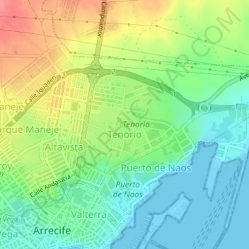
Name: Tenorio topographic map, elevation, terrain.
Location: Tenorio, Arrecife, Las Palmas, Kanarische Inseln, Spanien (28.96988 -13.54648 28.98110 -13.53233)
Average elevation: 29 m
Minimum elevation: -1 m
Maximum elevation: 75 m
Thank you for supporting this site ❤️
Make a donation
Make a donation
Gear up for your next adventure:
As an Amazon Associate, this site earns from qualifying purchases at no extra cost to you.