Geolocate

Githurai topographic map

Click on the map to display elevation.

About this map

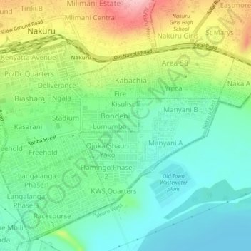
Name: Githurai topographic map, elevation, terrain.

Location: Githurai, Nakuru East, Nakuru, Rift Valley, 20100, Kenya (-0.31535 36.06464 -0.27535 36.10464)

Average elevation: 1,814 m

Minimum elevation: 1,755 m

Maximum elevation: 1,930 m

Gear up for your next adventure:

🪜Heavy Duty Carabiners - Multi-use clips for securing gear to your backpack
🚲Handlebar Phone Mount - View topographic-map.com live while cycling
💧Filtered Water Bottle - Safe drinking water on the go
🧰Emergency Multi-Tool - Compact multi-tool for outdoor survival
🥾Durable Hiking Shoes - Long-lasting shoes for frequent hiking

As an Amazon Associate, this site earns from qualifying purchases at no extra cost to you.