
Thank you for supporting this site ❤️
Make a donation
Make a donation
Gear up for your next adventure:
As an Amazon Associate, this site earns from qualifying purchases at no extra cost to you.
Valparaíso topographic map
Click on the map to display elevation.
Thank you for supporting this site ❤️
Make a donation
Make a donation
Gear up for your next adventure:
As an Amazon Associate, this site earns from qualifying purchases at no extra cost to you.
About this map
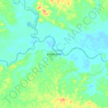
Name: Valparaíso topographic map, elevation, terrain.
Location: Valparaíso, Caquetá, RAP Amazonía, Colombia (1.15612 -75.74597 1.23612 -75.66597)
Average elevation: 229 m
Minimum elevation: 215 m
Maximum elevation: 268 m
Thank you for supporting this site ❤️
Make a donation
Make a donation
Gear up for your next adventure:
As an Amazon Associate, this site earns from qualifying purchases at no extra cost to you.