Geolocate

Bruca topographic map

Click on the map to display elevation.

About this map

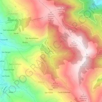
Name: Bruca topographic map, elevation, terrain.

Location: Bruca, Moira, Tortorici, Messina, Sicily, 98078, Italy (38.02328 14.82871 38.06328 14.86871)

Average elevation: 826 m

Minimum elevation: 394 m

Maximum elevation: 1,141 m

Gear up for your next adventure:

🧰Emergency Multi-Tool - Compact multi-tool for outdoor survival
🧢Beanie Hat - Keep your head warm in cold weather
🥫Freeze-Dried Meals - Lightweight, high-calorie nutrition for multi-day treks
🛶Canoe Life Vest - Safety vest for water sports
🔪Outdoor Multitool - Versatile tool for repairs and food prep in the wild

As an Amazon Associate, this site earns from qualifying purchases at no extra cost to you.