Geolocate

Mount Balagbag topographic map

Click on the map to display elevation.

About this map

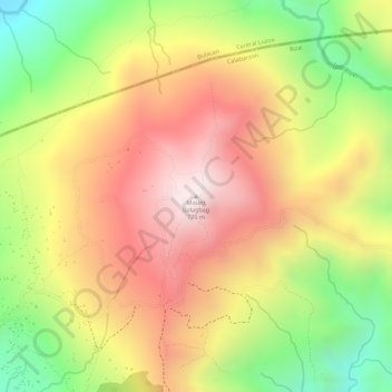
Name: Mount Balagbag topographic map, elevation, terrain.

Location: Mount Balagbag, Montalban, Rizal, Calabarzon, Philippines (14.82426 121.18036 14.82436 121.18046)

Average elevation: 512 m

Minimum elevation: 178 m

Maximum elevation: 769 m

Other topographic maps

Click on a map to view its topography, its elevation and its terrain.

Wawa Dam

Philippines > Rizal > Montalban > Wawa > Inigan

Average elevation: 156 m

Gear up for your next adventure:

🔋Lithium AA Batteries - Long-lasting power that performs in extreme cold
🧥Fleece Jacket - Warm and lightweight jacket for layering
🥾Approach Shoes - Shoes designed for climbing approaches and rugged trails
🥾All-Terrain Hiking Boots - Versatile boots for varied hiking conditions
Camping Groundsheet - Protect your tent from moisture and dirt

As an Amazon Associate, this site earns from qualifying purchases at no extra cost to you.