Geolocate

Burlington topographic map

Click on the map to display elevation.

About this map

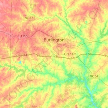
Name: Burlington topographic map, elevation, terrain.

Location: Burlington, Alamance County, North Carolina, United States (36.00971 -79.62141 36.12776 -79.37193)

Average elevation: 186 m

Minimum elevation: 136 m

Maximum elevation: 232 m

Other topographic maps

Click on a map to view its topography, its elevation and its terrain.

Glencoe

United States > North Carolina > Alamance County

Average elevation: 184 m

Elon

United States > North Carolina > Alamance County > Elon

Average elevation: 201 m

Gear up for your next adventure:

🛁Quick-Dry Microfiber Towel - Space-saving towel that dries rapidly on the move
🕶️Polarized Sunglasses - Reduces glare from snow and water at high elevations
🛌Insulated Sleeping Pad - Critical thermal barrier between you and the cold ground
🥾Trail Hiking Shoes - Durable shoes designed for rugged trails
💡LED Camping Lantern - Illuminate your campsite with long-lasting lanterns

As an Amazon Associate, this site earns from qualifying purchases at no extra cost to you.