
Terwolde topographic map
Interactive map
Click on the map to display elevation.
About this map
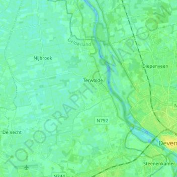
Name: Terwolde topographic map, elevation, terrain.
Location: Terwolde, Voorst, Geldern, Niederlande (52.23785 6.02480 52.31782 6.13007)
Average elevation: 5 m
Minimum elevation: -4 m
Maximum elevation: 17 m
Other topographic maps
Click on a map to view its topography, its elevation and its terrain.