Geolocate

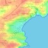
Creach Manuel topographic map

Click on the map to display elevation.

About this map

Name: Creach Manuel topographic map, elevation, terrain.

Location: Creach Manuel, Plougonvelin, Brest, Finistère, Bretagne, France métropolitaine, 29217, France (48.32581 -4.74054 48.36581 -4.70054)

Average elevation: 29 m

Minimum elevation: -6 m

Maximum elevation: 63 m

Other topographic maps

Click on a map to view its topography, its elevation and its terrain.
Gear up for your next adventure:

🧴Sunscreen SPF - Broad-spectrum sunscreen for outdoor activities
💡Portable Camping Lamp - Rechargeable lamp for campsite lighting
💧Hydration Pack - Hands-free hydration system for long hikes
🏃Hydration Running Vest - Carry water and maps close to your body for speed
🦶Hiking Shoe Insoles - Added support for high arches and long days on feet

As an Amazon Associate, this site earns from qualifying purchases at no extra cost to you.