
Thank you for supporting this site ❤️
Make a donation
Make a donation
Gear up for your next adventure:
As an Amazon Associate, this site earns from qualifying purchases at no extra cost to you.
Villagrande topographic map
Click on the map to display elevation.
Thank you for supporting this site ❤️
Make a donation
Make a donation
Gear up for your next adventure:
As an Amazon Associate, this site earns from qualifying purchases at no extra cost to you.
About this map
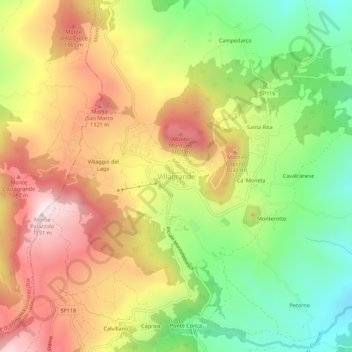
Name: Villagrande topographic map, elevation, terrain.
Location: Villagrande, Montecopiolo, Pesaro e Urbino, Marche, Italia (43.82023 12.33918 43.86023 12.37918)
Average elevation: 875 m
Minimum elevation: 577 m
Maximum elevation: 1,187 m
Thank you for supporting this site ❤️
Make a donation
Make a donation
Gear up for your next adventure:
As an Amazon Associate, this site earns from qualifying purchases at no extra cost to you.