Geolocate

Vijagual topographic map

Click on the map to display elevation.

About this map

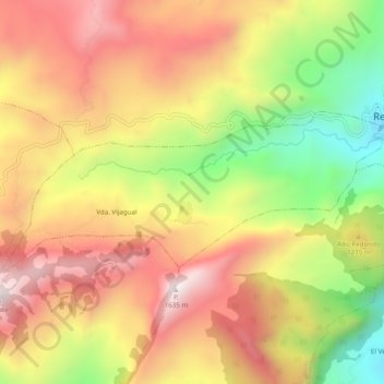
Name: Vijagual topographic map, elevation, terrain.

Location: Vijagual, Recetor, Casanare, Colombia (5.20988 -72.81002 5.23040 -72.76129)

Average elevation: 1,229 m

Minimum elevation: 739 m

Maximum elevation: 1,622 m

Gear up for your next adventure:

🌬️Windproof Camp Stove - Efficient cooking even on exposed mountain peaks
🥾Waterproof Trail Shoes - Shoes designed to handle wet terrain
🥾Mountaineering Boots - Supportive boots for climbing and high-altitude hiking
🧴Outdoor Sunscreen - High SPF protection for high-altitude UV exposure
🔨Vehicle Emergency Tool - Safety tool for remote road trips to trailheads

As an Amazon Associate, this site earns from qualifying purchases at no extra cost to you.