
Thank you for supporting this site ❤️
Make a donation
Make a donation
Gear up for your next adventure:
As an Amazon Associate, this site earns from qualifying purchases at no extra cost to you.
Kawant topographic map
Click on the map to display elevation.
Thank you for supporting this site ❤️
Make a donation
Make a donation
Gear up for your next adventure:
As an Amazon Associate, this site earns from qualifying purchases at no extra cost to you.
About this map
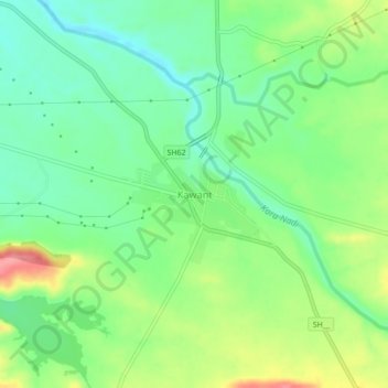
Name: Kawant topographic map, elevation, terrain.
Location: Kawant, Kavant Taluka, Chhota Udaipur, Gujarat, 391170, India (22.07317 74.03045 22.11317 74.07045)
Average elevation: 200 m
Minimum elevation: 167 m
Maximum elevation: 256 m
Thank you for supporting this site ❤️
Make a donation
Make a donation
Gear up for your next adventure:
As an Amazon Associate, this site earns from qualifying purchases at no extra cost to you.