Geolocate

Bersezio topographic map

Click on the map to display elevation.

About this map

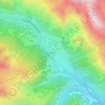
Name: Bersezio topographic map, elevation, terrain.

Location: Bersezio, Argentera, Cuneo, Piemonte, Italia (44.36065 6.94900 44.40065 6.98900)

Average elevation: 1,970 m

Minimum elevation: 1,449 m

Maximum elevation: 2,799 m

Gear up for your next adventure:

🥾Lightweight Hiking Shoes - Comfortable shoes for day hikes
🛰️Satellite Messenger - Emergency communication for areas with no cell service
🧶550 Survival Paracord - Versatile utility cord for emergency repairs and rigging
Lightweight Camping Tent - Portable shelter optimized for Canadian backcountry camping
💡Compact LED Flashlight - Powerful and portable flashlight for outdoor use

As an Amazon Associate, this site earns from qualifying purchases at no extra cost to you.