Geolocate

Vda. Orinoco topographic map

Click on the map to display elevation.

About this map

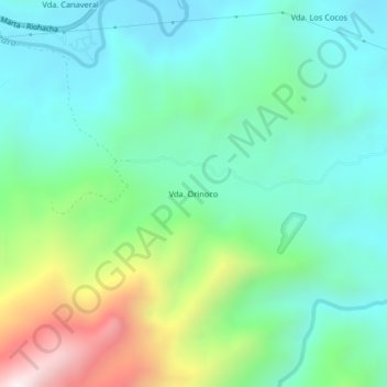
Name: Vda. Orinoco topographic map, elevation, terrain.

Location: Vda. Orinoco, Santa Marta, Magdalena, Colombia (11.24004 -73.92633 11.28004 -73.88633)

Average elevation: 307 m

Minimum elevation: 17 m

Maximum elevation: 1,089 m

Gear up for your next adventure:

🧥Fleece Jacket - Warm and lightweight jacket for layering
🪜Heavy Duty Carabiners - Multi-use clips for securing gear to your backpack
🏃Hydration Running Vest - Carry water and maps close to your body for speed
🕶️Polarized Sunglasses - Reduces glare from snow and water at high elevations
🌡️Emergency Mylar Blankets - Compact thermal protection for unexpected nights outdoors

As an Amazon Associate, this site earns from qualifying purchases at no extra cost to you.