Geolocate

Halang topographic map

Click on the map to display elevation.

About this map

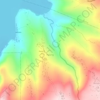
Name: Halang topographic map, elevation, terrain.

Location: Halang, Lipa, Batangas, Calabarzon, 4217, Philippines (13.94011 121.07067 13.96253 121.09185)

Average elevation: 171 m

Minimum elevation: -19 m

Maximum elevation: 364 m

Gear up for your next adventure:

🧴First Aid Kit - Essential first aid supplies for outdoor emergencies
🧦Crew Hiking Socks - Comfortable socks for long-distance hikes
🧣Merino Neck Gaiter - Protects against wind, sun, and cold at high altitudes
🧢Hiking Hat - Sun-protective and breathable hats for long treks
🥾Light Trekking Boots - Supportive boots for multi-day treks

As an Amazon Associate, this site earns from qualifying purchases at no extra cost to you.