

Steinbachtal topographic map
Click on the map to display elevation.
Steinbachtal
Das Tal des Steinbachs ist linksmainisch gelegen, beginnt auf Höhe des Sebastian-Kneipp-Stegs und verläuft südlich des Nikolausbergs. Entlang des Bachs befindet sich eine Parkanlage, die sich im Lauf des Tals langsam verbreitert und in den Würzburger Stadtwald mündet.
About this map
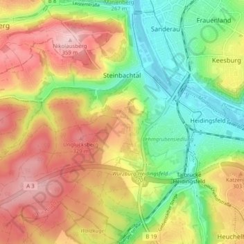
Name: Steinbachtal topographic map, elevation, terrain.
Location: Steinbachtal, Würzburg, Bayern, 97082, Deutschland (49.73922 9.87443 49.78890 9.93996)
Average elevation: 262 m
Minimum elevation: 170 m
Maximum elevation: 362 m