Geolocate

Jeumpa topographic map

Click on the map to display elevation.

About this map

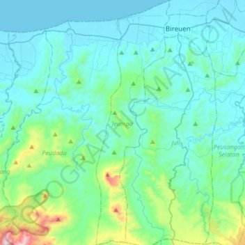
Name: Jeumpa topographic map, elevation, terrain.

Location: Jeumpa, Bireuen, Aceh, Sumatra, Indonesia (4.96374 96.61151 5.23326 96.69254)

Average elevation: 171 m

Minimum elevation: 0 m

Maximum elevation: 1,239 m

Other topographic maps

Click on a map to view its topography, its elevation and its terrain.

Blang Mee

Indonesia > Aceh > Bireuen

Average elevation: 15 m

Blang Mee

Indonesia > Aceh > Bireuen

Average elevation: 15 m

Gear up for your next adventure:

🕶️Polarized Sunglasses - Protect your eyes with durable polarized lenses
🧥Thermal Fleece Jacket - Versatile insulation for changing mountain temperatures
🧳Compression Sacks - Maximize space in your backpack by shrinking gear
🥽Outdoor Goggles - Protective eyewear for outdoor activities
🥾Durable Hiking Shoes - Long-lasting shoes for frequent hiking

As an Amazon Associate, this site earns from qualifying purchases at no extra cost to you.