Geolocate

Bucksport topographic map

Click on the map to display elevation.

About this map

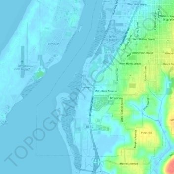
Name: Bucksport topographic map, elevation, terrain.

Location: Bucksport, Eureka, Humboldt County, California, 95564, United States (40.75515 -124.21253 40.79515 -124.17253)

Average elevation: 8 m

Minimum elevation: -6 m

Maximum elevation: 56 m

Other topographic maps

Click on a map to view its topography, its elevation and its terrain.

Gear up for your next adventure:

🛏️Sleeping Bag - Warm and compact sleeping bags for outdoor camping
🧣Evaporative Cooling Towel - Beat the heat during intense summer climbs
🛁Quick-Dry Microfiber Towel - Space-saving towel that dries rapidly on the move
🧴First Aid Kit - Essential first aid supplies for outdoor emergencies
🚑Survival Whistle - Signal for help across long distances in mountains

As an Amazon Associate, this site earns from qualifying purchases at no extra cost to you.