
Make a donation
Gear up for your next adventure:
As an Amazon Associate, this site earns from qualifying purchases at no extra cost to you.
Paljuvi topographic map
Click on the map to display elevation.
Make a donation
Gear up for your next adventure:
As an Amazon Associate, this site earns from qualifying purchases at no extra cost to you.
About this map
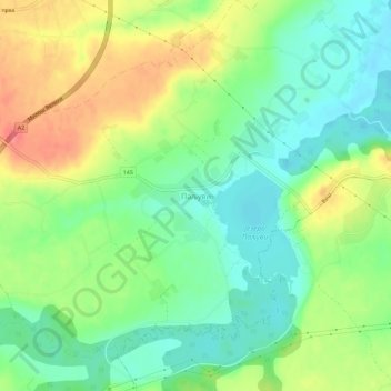
Name: Paljuvi topographic map, elevation, terrain.
Average elevation: 129 m
Minimum elevation: 100 m
Maximum elevation: 172 m
Make a donation
Gear up for your next adventure:
As an Amazon Associate, this site earns from qualifying purchases at no extra cost to you.
Other topographic maps
Click on a map to view its topography, its elevation and its terrain.
Stublenica
Serbia > Central Serbia > Kolubara Administrative District > Ub Municipality
Average elevation: 130 m
Trlic
Serbia > Central Serbia > Kolubara Administrative District > Ub Municipality
Average elevation: 127 m
Sovljak
Serbia > Central Serbia > Kolubara Administrative District > Ub Municipality
Average elevation: 107 m