Geolocate

Itawa topographic map

Click on the map to display elevation.

About this map

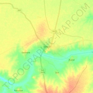
Name: Itawa topographic map, elevation, terrain.

Location: Itawa, Pipalda Tehsil, Kota District, Rajasthan, 325004, India (25.49885 76.33897 25.57885 76.41897)

Average elevation: 225 m

Minimum elevation: 203 m

Maximum elevation: 242 m

Gear up for your next adventure:

🪑Ultralight Camping Stool - Compact seating for rest stops during long hikes
🧥Ultralight Puffy Jacket - Maximum warmth that packs down to the size of an orange
🔥Emergency Fire Starter - Reliable ignition source for all weather conditions
🥾Mountaineering Boots - Supportive boots for climbing and high-altitude hiking
💡Portable Camping Lamp - Rechargeable lamp for campsite lighting

As an Amazon Associate, this site earns from qualifying purchases at no extra cost to you.