Geolocate

Manuali topographic map

Click on the map to display elevation.

About this map

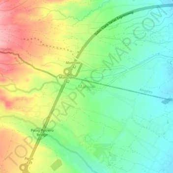
Name: Manuali topographic map, elevation, terrain.

Location: Manuali, Porac, Pampanga, Central Luzon, 2023, Philippines (15.12358 120.50399 15.16358 120.54399)

Average elevation: 199 m

Minimum elevation: 145 m

Maximum elevation: 278 m

Gear up for your next adventure:

💧Collapsible Water Bottle - Space-saving water bottle for outdoor activities
🧴Waterproofing Spray - Restore the DWR coating on jackets and tents
🧊Insulated Water Bottle - Keeps drinks cold in summer and prevents freezing in winter
💡Solar Camping Lamp - Eco-friendly lighting for campsites
🥾Durable Hiking Shoes - Long-lasting shoes for frequent hiking

As an Amazon Associate, this site earns from qualifying purchases at no extra cost to you.