Geolocate

Hawley topographic map

Click on the map to display elevation.

About this map

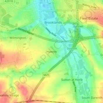
Name: Hawley topographic map, elevation, terrain.

Location: Hawley, Dartford, Kent, England, DA2 7SA, United Kingdom (51.40190 0.20272 51.44190 0.24272)

Average elevation: 35 m

Minimum elevation: 5 m

Maximum elevation: 75 m

Gear up for your next adventure:

🧤Rechargeable Heated Gloves - Extreme warmth for Canadian winter expeditions
📷Outdoor Action Camera - Capture high-elevation views and rugged adventures
💧Reusable Water Bottle - Durable water bottles for hydration on trails
🧊Portable Cooler - Keep food and drinks cold during outdoor adventures
🔭Compact Monocular - One-handed bird watching and trail spotting

As an Amazon Associate, this site earns from qualifying purchases at no extra cost to you.