
Thank you for supporting this site ❤️
Make a donation
Make a donation
Gear up for your next adventure:
As an Amazon Associate, this site earns from qualifying purchases at no extra cost to you.
Sangad topographic map
Click on the map to display elevation.
Thank you for supporting this site ❤️
Make a donation
Make a donation
Gear up for your next adventure:
As an Amazon Associate, this site earns from qualifying purchases at no extra cost to you.
About this map
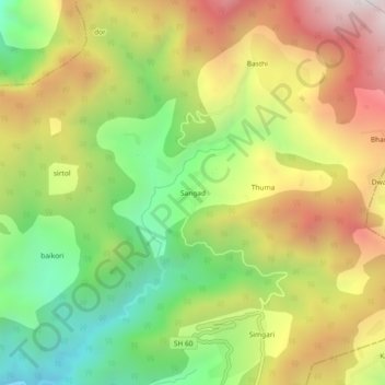
Name: Sangad topographic map, elevation, terrain.
Location: Sangad, Kanda, Bageshwar, Uttarakhand, 263640, India (29.88537 79.98025 29.92537 80.02025)
Average elevation: 1,904 m
Minimum elevation: 1,342 m
Maximum elevation: 2,544 m
Thank you for supporting this site ❤️
Make a donation
Make a donation
Gear up for your next adventure:
As an Amazon Associate, this site earns from qualifying purchases at no extra cost to you.