
Thank you for supporting this site ❤️
Make a donation
Make a donation
Gear up for your next adventure:
As an Amazon Associate, this site earns from qualifying purchases at no extra cost to you.
Chiatura topographic map
Click on the map to display elevation.
Thank you for supporting this site ❤️
Make a donation
Make a donation
Gear up for your next adventure:
As an Amazon Associate, this site earns from qualifying purchases at no extra cost to you.
About this map
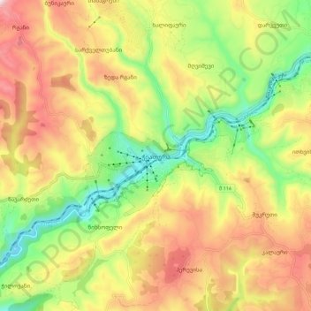
Name: Chiatura topographic map, elevation, terrain.
Location: Chiatura, Raion Chiatura, Imereti, 5500, Georgia (42.25102 43.24884 42.33102 43.32884)
Average elevation: 603 m
Minimum elevation: 326 m
Maximum elevation: 905 m
Thank you for supporting this site ❤️
Make a donation
Make a donation
Gear up for your next adventure:
As an Amazon Associate, this site earns from qualifying purchases at no extra cost to you.