Geolocate

Krandorf topographic map

Click on the map to display elevation.

About this map

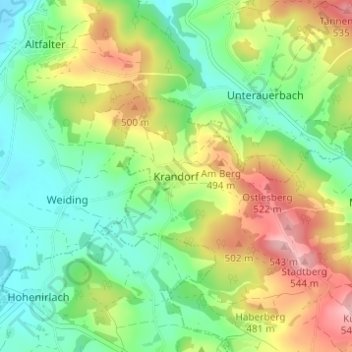
Name: Krandorf topographic map, elevation, terrain.

Location: Krandorf, Neunburg vorm Wald, Landkreis Schwandorf, Bayern, 92431, Deutschland (49.36155 12.21246 49.40155 12.25246)

Average elevation: 433 m

Minimum elevation: 364 m

Maximum elevation: 546 m

Other topographic maps

Click on a map to view its topography, its elevation and its terrain.

Gear up for your next adventure:

🥾Hiking Boots - Sturdy boots providing ankle support and traction on rugged trails
🦟Insect Repellent - Keep mosquitoes and black flies away in wooded areas
🥾Approach Boots - Comfortable boots for hiking and climbing approaches
🧢Sun Hat - Wide-brim hat for sun protection
🔨Vehicle Emergency Tool - Safety tool for remote road trips to trailheads

As an Amazon Associate, this site earns from qualifying purchases at no extra cost to you.