
Thank you for supporting this site ❤️
Make a donation
Make a donation
Gear up for your next adventure:
As an Amazon Associate, this site earns from qualifying purchases at no extra cost to you.
Schanz topographic map
Click on the map to display elevation.
Thank you for supporting this site ❤️
Make a donation
Make a donation
Gear up for your next adventure:
As an Amazon Associate, this site earns from qualifying purchases at no extra cost to you.
About this map
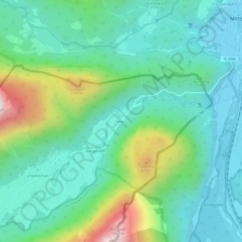
Name: Schanz topographic map, elevation, terrain.
Location: Schanz, Leutasch, Bezirk Innsbruck-Land, Tirol, Österreich (47.40475 11.21149 47.44475 11.25149)
Average elevation: 1,169 m
Minimum elevation: 914 m
Maximum elevation: 1,933 m
Thank you for supporting this site ❤️
Make a donation
Make a donation
Gear up for your next adventure:
As an Amazon Associate, this site earns from qualifying purchases at no extra cost to you.
Other topographic maps
Click on a map to view its topography, its elevation and its terrain.