Geolocate

Joppa topographic map

Click on the map to display elevation.

About this map

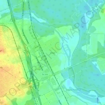
Name: Joppa topographic map, elevation, terrain.

Location: Joppa, Dallas, Dallas County, Texas, 75216, United States (32.69268 -96.76469 32.73268 -96.72469)

Average elevation: 126 m

Minimum elevation: 114 m

Maximum elevation: 148 m

Other topographic maps

Click on a map to view its topography, its elevation and its terrain.

Kessler Parkway

United States > Texas > Dallas County > Dallas

Average elevation: 137 m

Klyde Warren Park

United States > Texas > Dallas County > Dallas

Average elevation: 142 m

Lake Shirley

United States > Texas > Dallas County > Dallas

Average elevation: 199 m

Dealey Plaza

United States > Texas > Dallas County > Dallas

Average elevation: 132 m

Dealey Plaza

United States > Texas > Dallas County > Dallas

Average elevation: 132 m

Klyde Warren Park

United States > Texas > Dallas County > Dallas

Average elevation: 142 m

Gear up for your next adventure:

🧥Softshell Jacket - Windproof and breathable jacket for hiking
🦶Hiking Shoe Insoles - Added support for high arches and long days on feet
🧦Merino Wool Socks - Moisture-wicking comfort for long-distance hiking
🥾Trail Running Boots - Durable shoes designed for trail running
🧥Ultralight Puffy Jacket - Maximum warmth that packs down to the size of an orange

As an Amazon Associate, this site earns from qualifying purchases at no extra cost to you.