Geolocate

Majhach topographic map

Click on the map to display elevation.

About this map

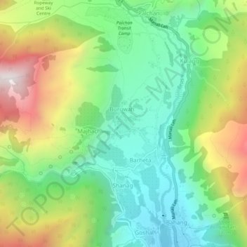
Name: Majhach topographic map, elevation, terrain.

Location: Majhach, Manali, Kullu, Himachal Pradesh, 175103, India (32.27162 77.15097 32.31162 77.19097)

Average elevation: 2,440 m

Minimum elevation: 2,002 m

Maximum elevation: 3,203 m

Gear up for your next adventure:

🧢Sun Protection Cap - Breathable cap to protect from sun exposure
💧Hydration Bladder - Hands-free hydration solution for long treks
Bushcraft Tarp - Versatile emergency shelter or gear protection
🧰Emergency Multi-Tool - Compact multi-tool for outdoor survival
🧥Waterproof Jacket - Lightweight rain jackets for hiking and outdoor activities

As an Amazon Associate, this site earns from qualifying purchases at no extra cost to you.