
Thank you for supporting this site ❤️
Make a donation
Make a donation
Gear up for your next adventure:
As an Amazon Associate, this site earns from qualifying purchases at no extra cost to you.
Bernués topographic map
Click on the map to display elevation.
Thank you for supporting this site ❤️
Make a donation
Make a donation
Gear up for your next adventure:
As an Amazon Associate, this site earns from qualifying purchases at no extra cost to you.
About this map
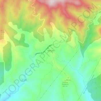
Name: Bernués topographic map, elevation, terrain.
Location: Bernués, Jaca, La Jacetania, Huesca, Aragonien, Spanien (42.45814 -0.60599 42.49814 -0.56599)
Average elevation: 926 m
Minimum elevation: 728 m
Maximum elevation: 1,236 m
Thank you for supporting this site ❤️
Make a donation
Make a donation
Gear up for your next adventure:
As an Amazon Associate, this site earns from qualifying purchases at no extra cost to you.